


Where
What it is and where it is
Setting out to discover the Forra del Cellina Nature Reserve is a unique opportunity to get in touch with the beauty of the local flora and fauna, to embark on exciting itineraries and to learn more about interesting topics related to the karst phenomena that, for millennia, have shaped and formed this territory. If you like contact with nature, nature trails and picturesque views, you just have to start planning your visit!
Why it is special
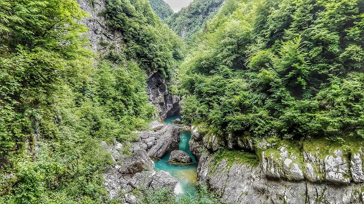
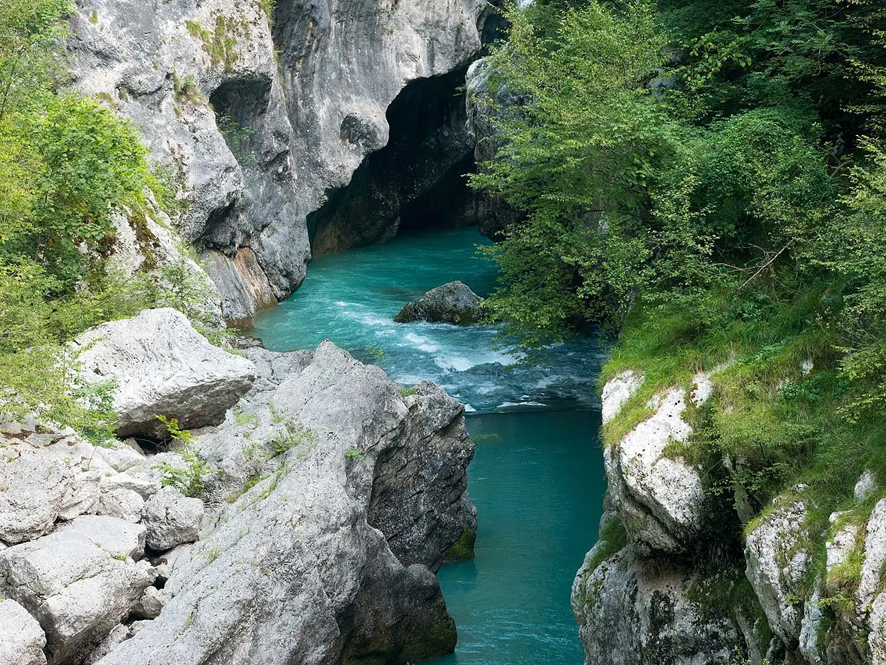
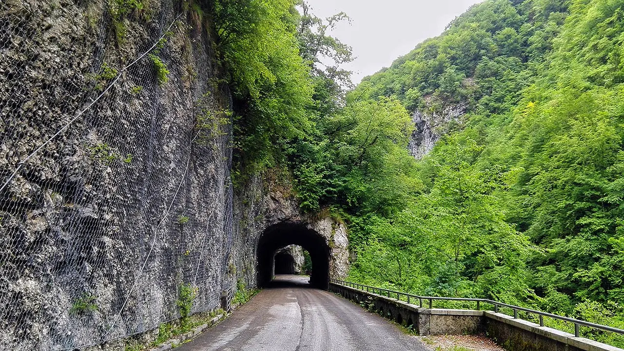
The old Valcellina road forms a fascinating route through one of the most beautiful and spectacular Nature Reserves in Friuli Venezia Giulia. The crystal-clear waters and deep canyons carved into the rocks make this stretch of road, which was once the valley's only link to the plains, unforgettable and enchanting. Today it is a destination for visitors from all over the world, curious to see with their own eyes those colors reflected in a unique environment between water, sky and rocks.
Not to be missed
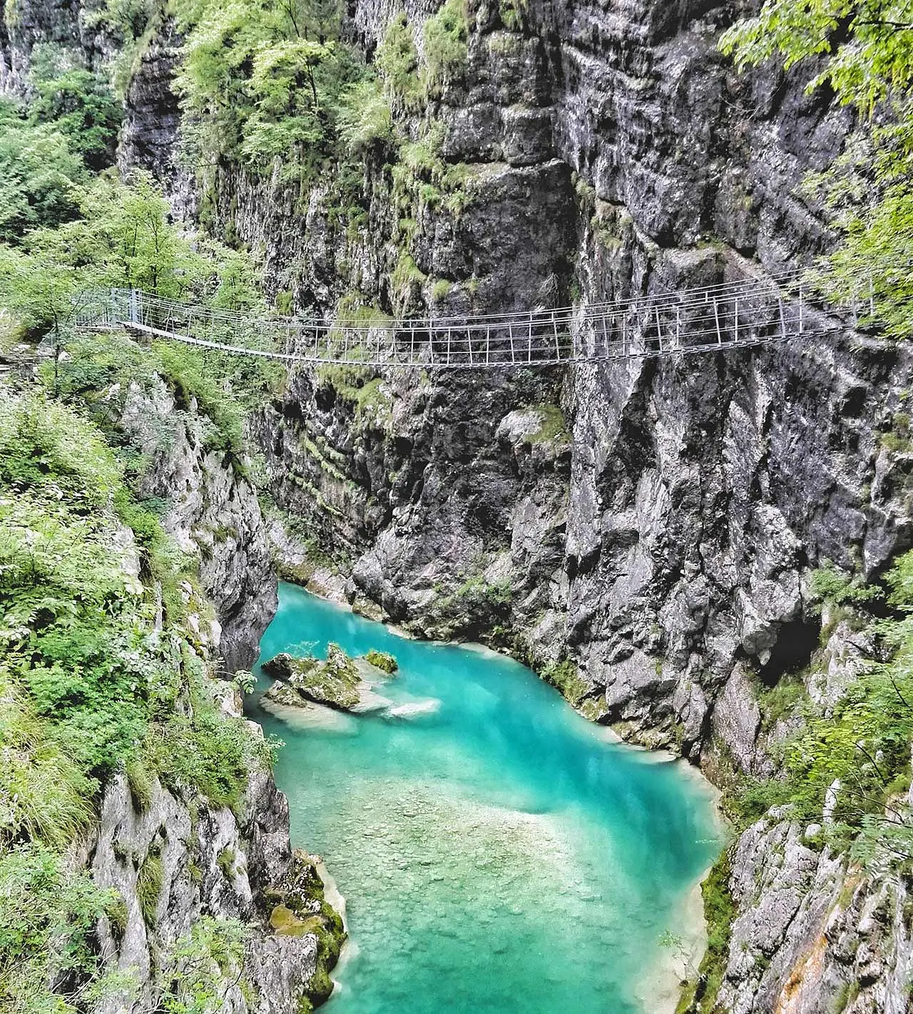
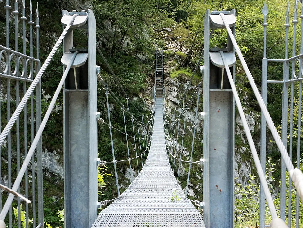
For the most daring (and especially for those who do not suffer from vertigo!) absolutely do not miss the walk on the Tibetan bridge, a 55m-long path built entirely of steel, which offers a spectacular and unexpected view (safely and in the company of trained personnel) of the gorge and the emerald waters of the Cellina stream. Another view not to be forgotten is offered by the Dint skywalk, consisting of a catwalk suspended in the void above the gorge, accessible from the Dint trail.
A bit of history
Established in 1996, the Forra del Cellina Nature Reserve covers an area of about 304 hectares that includes: the upper trunk of the Cellina stream's lock channel downstream of the Barcis basin, the narrow incision of the Molassa stream, the westernmost part of the Fara forest on the northern slope of Mt. Fara, and an area with steep rock walls on the northern slope of Mt. I Cameroni called I Pics. Carbonate rocks (limestones) from the Cretaceous period prevail here. The Reserve also includes, further north, an area with undulating morphology, located between the Molassa hamlet and Ponte Antoi locality, in which arenaceous-marly rocks prevail, named Dint locality.
Curiosities
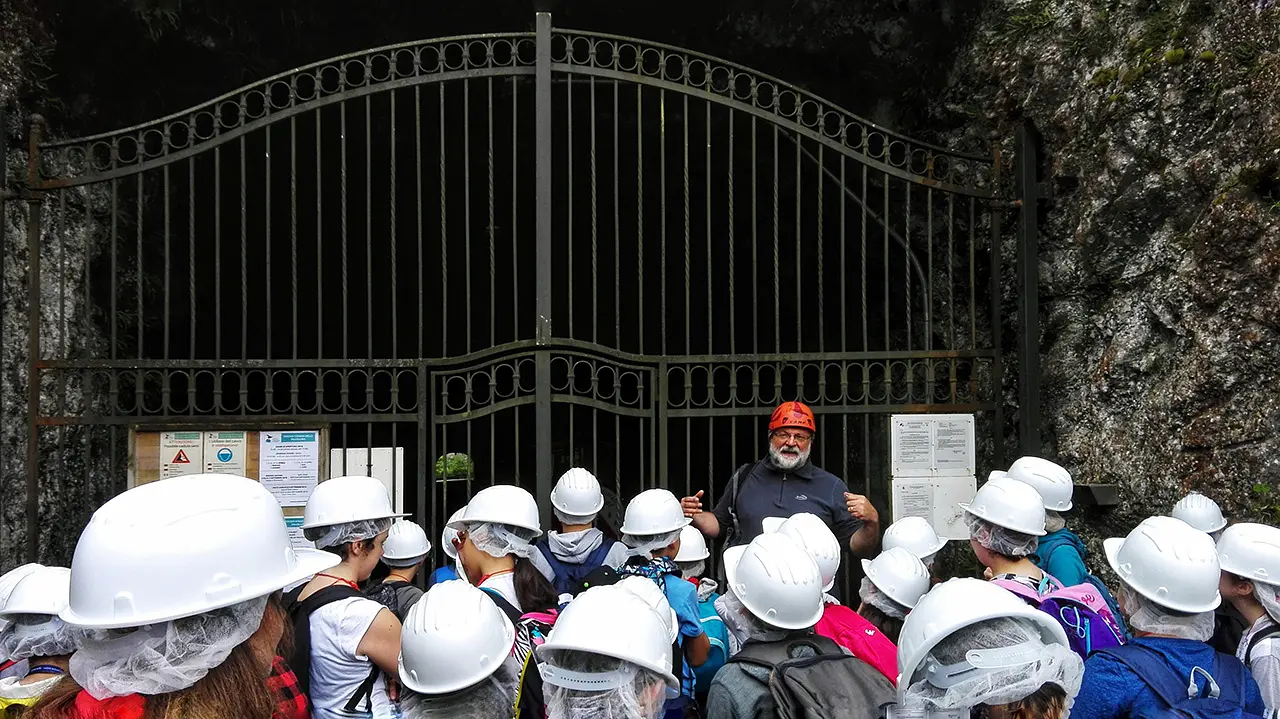
The Reserve also has a particular value from a historical point of view if we consider the works intended for the exploitation of the Cellina stream for hydroelectric purposes. In fact, the Cellina hydroelectric plants were built at different times, starting in the early 1900s with the construction of the "old dam," the feeder canal, and the Malnisio power plant. These plants were among the first of the "industrial" type built in Italy and remained in operation until 1988. The hydroelectric power produced at the Malnisio power plant was transferred via high-voltage lines to the cities of Venice, Treviso, and Udine.
Enter the Map of Italy's Hidden Wonders and find treasures where you least expect it... Inspire, Recommend, Share...
Collections
The Map thanks:
Enter the Map of Italy's Hidden Wonders and find treasures where you least expect it... Inspire, Recommend, Share...
Where
Collections