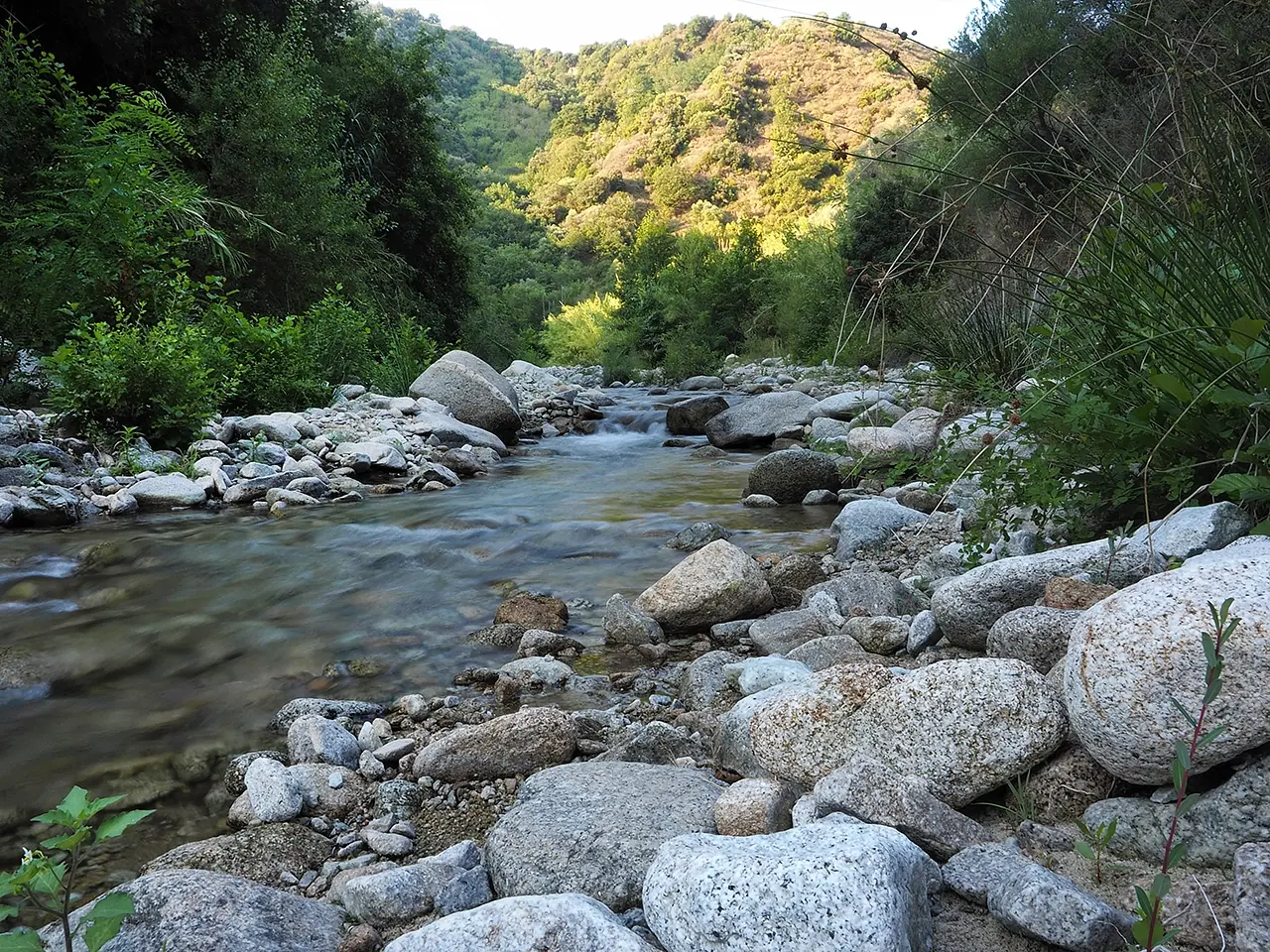


The Gallipari River
Calabrian rivers, so wide at the mouth, often reveal a surprising mountainous stretch


Where
A typical watercourse of the Serre
This watercourse originates in the heart of the Calabrian Serre from Mount San Nicola (m 1260). Steep at the start, it gradually subsides until it assumes the typical width of Calabrian rivers within sight of the Ionian Sea. For most of its course it represents the natural boundary between the municipalities of Isca and Badolato, while in the upper part of its course it briefly crosses the territory of Sant'Andrea. Despite its modest length, 18 kilometers, over the centuries it has represented a respectable function for the agricultural economy of the coastal populations. But not only that.
Upstream of the Romito power station
It dates back to 1920, in fact, the construction of the Romito hydroelectric power plant in the upper reaches of the river, in Isca territory. After supplying power for more than four decades to the municipalities in the basin, however, the plant faced abandonment. And yes, with the machinery still inside it, it would be a site of industrial archaeology worthy of attention. Today, if nothing else, it has become a landmark for hikers ascending the upper two branches of the river, each with a beautiful waterfall. The nearest is called Schioppo del Romito where 'schioppo' is the local word for precisely a noteworthy waterfall.
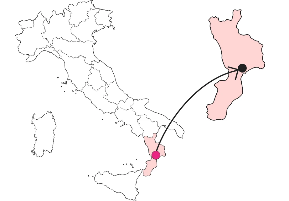
Echoes of an ancient battle
The Galliporo River, mentioned in ancient chronicles as Elléporo, has a certain historical relevance because of the battle that was fought on its banks in 389 B.C. between Syracuse and the so-called Italiote League, headed by Crotone, which aspired to primacy among the cities of Magna Graecia. The battle was the concluding event of the war campaign that the Syracusan tyrant Dionysius the Elder had initiated by laying siege to Caulonia, a city that garrisoned today's Punta Stilo, the remains of which fall under Monasterace.
Enter the Map of Italy's Hidden Wonders and find treasures where you least expect it... Inspire, Recommend, Share...
The Map thanks:

Enter the Map of Italy's Hidden Wonders and find treasures where you least expect it... Inspire, Recommend, Share...