


Where
What it is and where it is
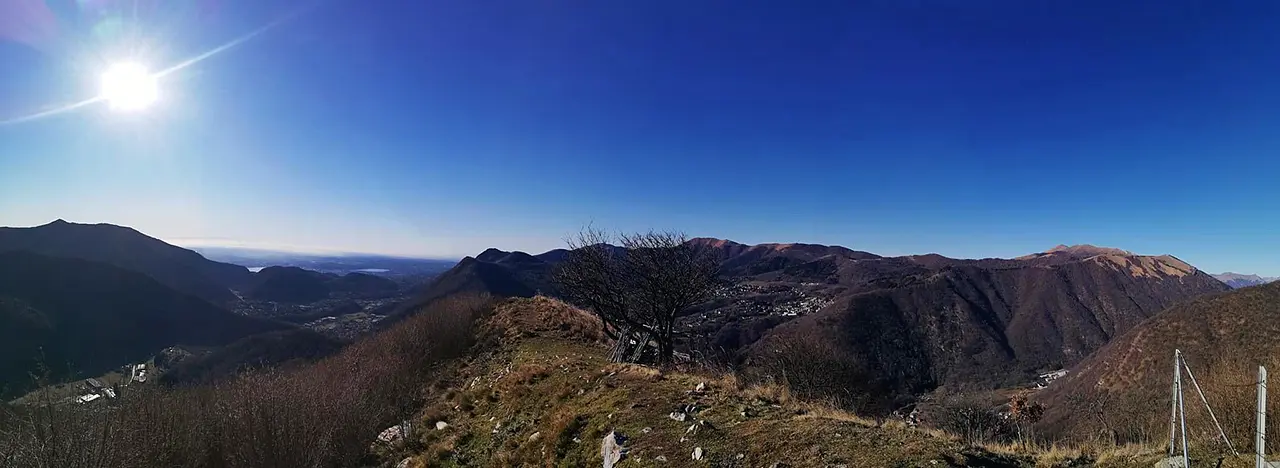
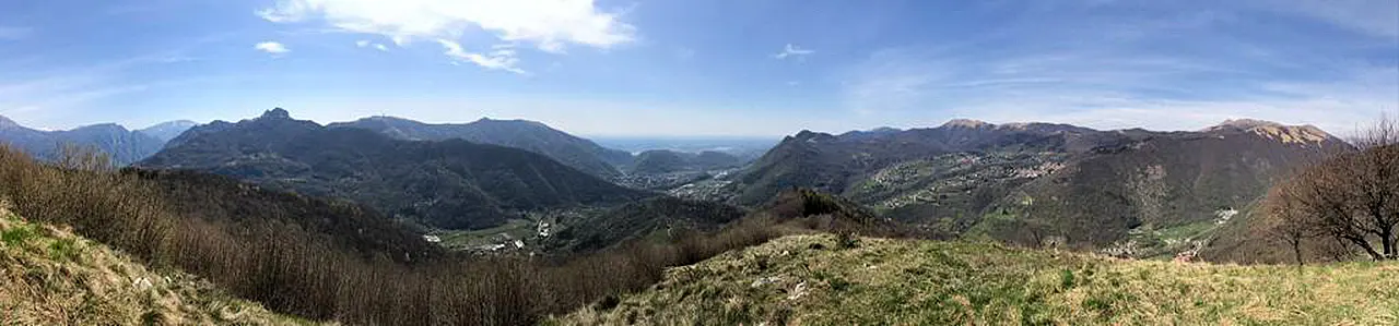
Mount Megna, at 1048 meters high, is the summit of the Larian Triangle. To those who climb to its summit it offers a 360-degree spectacle: to the right Mount Palanzone with its sharp point and on its slopes the villages of Sormano and Caglio; to the left the Corni di Canzo, a triptych recognizable all the way from Brianza. To the south gleam the lakes of Pusiano and Annone, farther on that of Montorfano and the Brianzola plain, which on clear days extends as far as Milan. To the east we glimpse Resegone and some patches of Lake Como, the city of Lecco and the Adda River. Also silhouetted against the sky are her majesty the Grigna and her faithful sentinel, the Grignetta.
Why it is special
Each mountain in the Larian Triangle expresses the identity and history of the people who lived it. Past and distant events are traced back to the present day, giving us paths traced over countless decades, rural structures that persist with the advance of time, crags carved into the slope to grow potatoes, and native forests made of chestnut and oak trees, so precious to the lives of families and their animals. Winter makes these peaks special because it sharpens the colors of the sunset: it brings them out in their full spectrum to provide exceptional natural spectacles.
Not to be missed
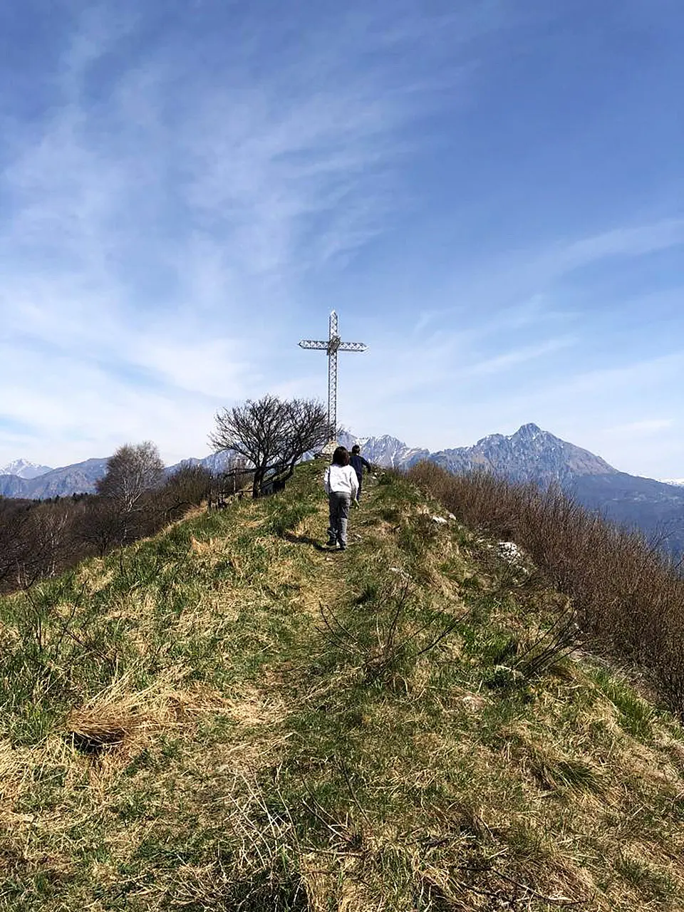
One of the most satisfying trails is the Erta del Giubileo, a path with long and steep climbs through which you can reach the summit of Mount Megna. It starts from Osigo di Valbrona, an ancient rural village dating back to the 1600s. The path unravels through centuries-old chestnut groves, winding hornbeam forests, majestic oaks and white birches. We encounter erratic boulders, one of which was connected to a large dry stone wall to create a shelter for shepherds who took their herds out to pasture for the warm season. We cross rural structures once used by farmers and shepherds. From the summit we descend along a path dotted with chapels of the Way of the Cross created by Assisian Gianfranco Gaslini. We reach the Conca di Crezzo and then return to Osigo di Valbrona.
A bit of history
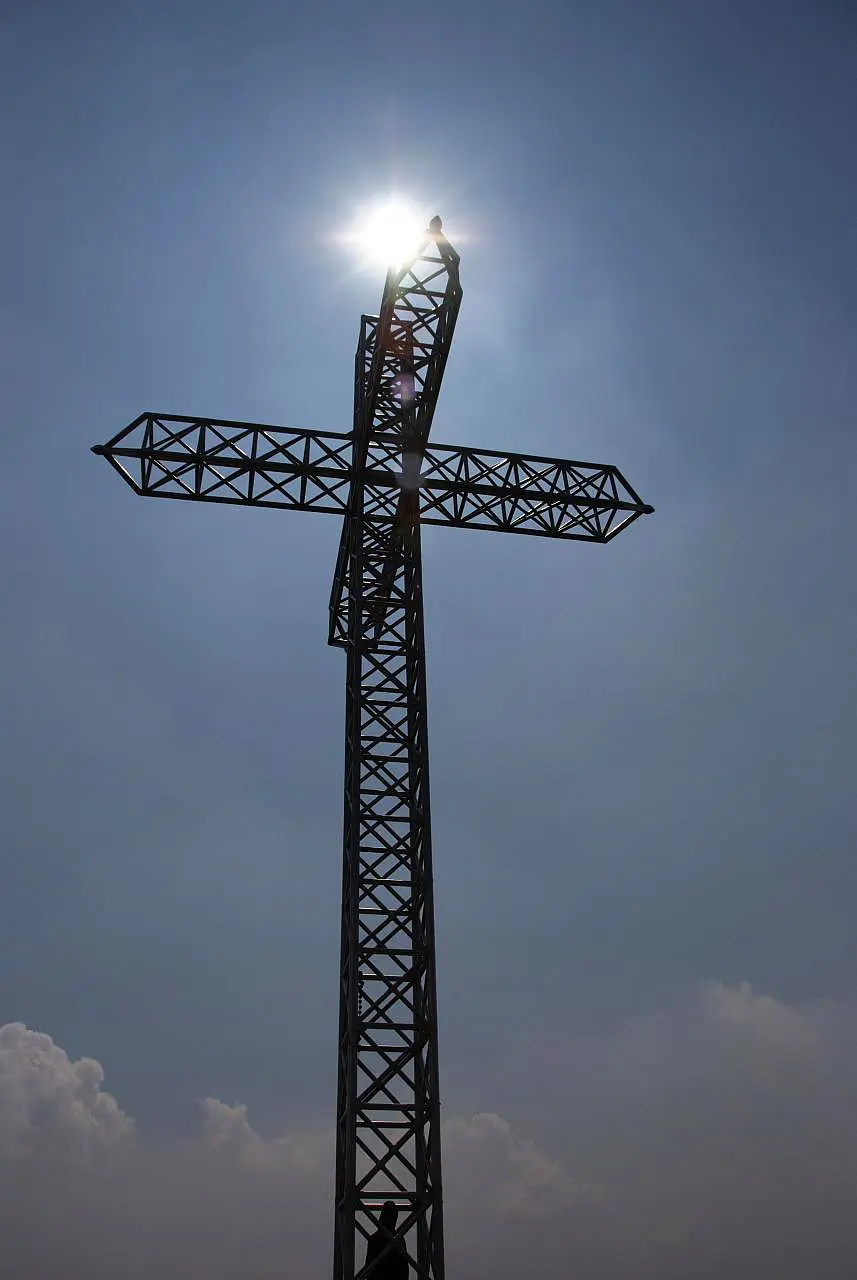
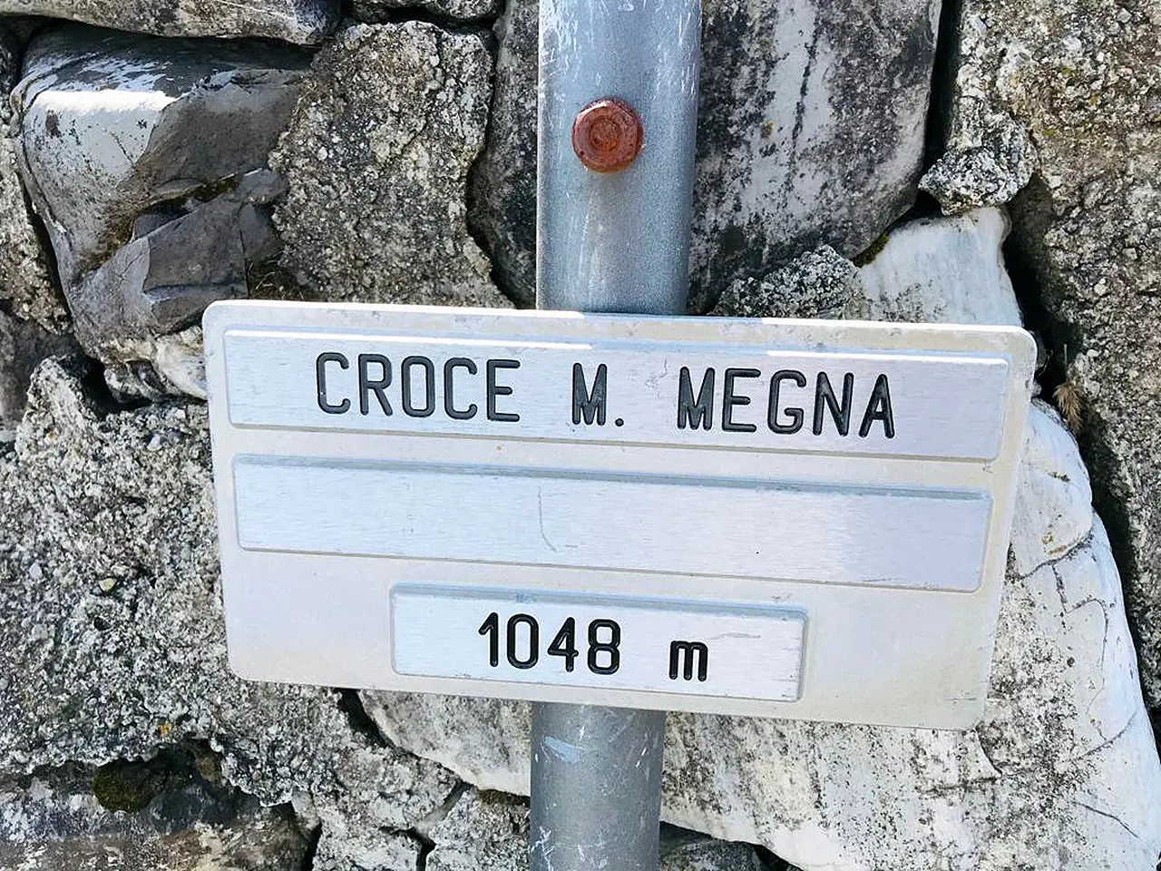
The summit of Mount Megna is embellished by an imposing steel cross that was commissioned by Monsignor Francantonio Bernasconi in 2000, then parish priest of Asso and Lasnigo to celebrate the Holy Year of Jubilee. At the base is a steel box, which holds a logbook for hikers to recount their visit.
Trivia
As you walk you may encounter a water tollgate, which allowed farmers to keep their food cool. Tollhouses were built to the north or above a spring or near a stream, which was channeled to the base of the structure and then drained away. Shepherds would deposit conche (large copper vessels) full of milk there: the cool temperature allowed the cream to rise, which was then used to make butter with churns.
Enter the Map of Italy's Hidden Wonders and find treasures where you least expect it... Inspire, Recommend, Share...
Collections
The Map thanks:
Enter the Map of Italy's Hidden Wonders and find treasures where you least expect it... Inspire, Recommend, Share...