logo

SHARRYLAND

Experience the Map of Wonders

WHAT

Enter a keyword

WHERE

Enter a place

WHEN

Select a period
  • Register, it's free!
  • Do you already have an account?

    Sign in
  • link image Explore
  • Favorites
  • Community
  • Shop
  • What the Map does
  • Cherry-o-meter
  • Gift Card
  • Are you a Local Operator?

  • Be found in the map
ciliegia
Cherry-o-meter
by Martina Fontanella
Profile
Profile  }  Seeker of Wonders

Martina Fontanella

Senna Lodigiana, LO
Nature
Nature
Villages
Villages
Handicrafts
Handicrafts

Useful info

My activities in the map

My contribution to the Map
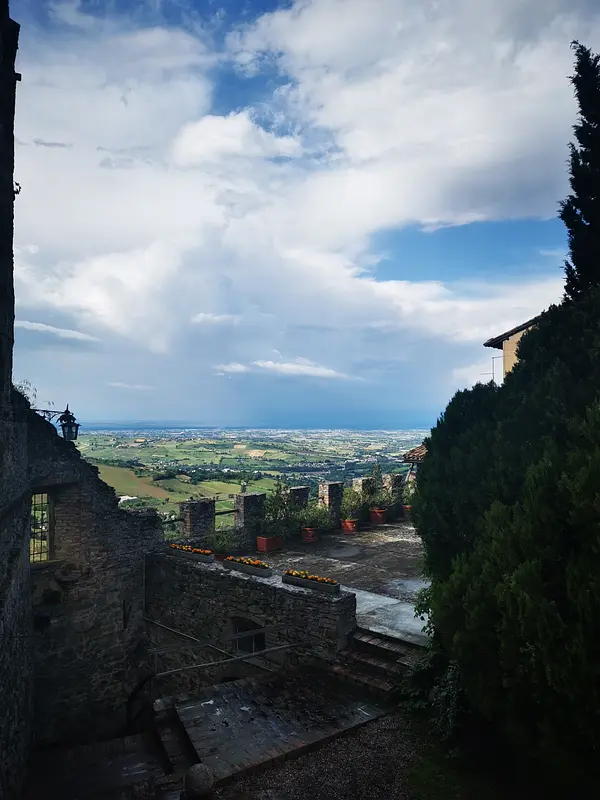
Pianello Val Tidone, PC
Olgisio Rock
tipologia
Flash

Olgisio Rock

It is a fortified complex located on a steep cliff between the Tidone and Chiarone valleys in the municipality of Pianello Val Tidone. Beautiful interiors and views can be enjoyed from here.

sharry logo

SharryLand

What is SharryLandWho we arevaluesPress&NewsTerritorial contact personWork with usContacts

Support

What the Map doesLocal operatorsPro GuideAssistance - FAQTalk to usTerms and conditionsTerms of salePrivacy Policy

Searches

'I Land': destinations of another ItalyIn the municipality of.In the province of.In the region of.
 Google Play  App Store
SharryLand
What is SharryLandWho we arePress&NewsWork with usContacts
The Map of Wonders
Assistance - FAQLocal operatorsThe Map on your site
Work with us
Travel Co-ordinatorTerritorial contact personFor CompaniesBecome a Common FriendFriendly CommonsCurrent collaborations

Our App

 Google Play  App Store Secure payments via stripe
payment methods
© SharryLand srl Società Benefit - P.I. 05096140289
Secure payments via stripe
payment methods
  • Home
  • Search
  • Favorites
  • Community
  • Shop
  • Enter