SHARRYLAND


Where is
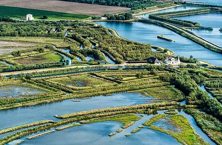
The Po della Gnocca is the branch of the Delta that detaches from the main course and descends southeastward, stretching between the more inland and completely reclaimed Ariano Island and the Donzella Island, which on the seaward side transcolates into the waters of the Sacca di Scardovari. Who was the 'damsel' in question is not known with certainty because the story transcolors into legend. The starting fact concerns the Venetian Farsetti family, which had large properties here. Instead, two versions are given of the young woman in question : a romantic one, which sees her committing suicide in the river because of a love opposed by her father; a more sanguine one, which describes her as beautiful and exuberant and for this reason confined far from the worldliness of Venice. A version, the latter, that would also give explanation for the current, somewhat explicit name of Po di Gnocca.
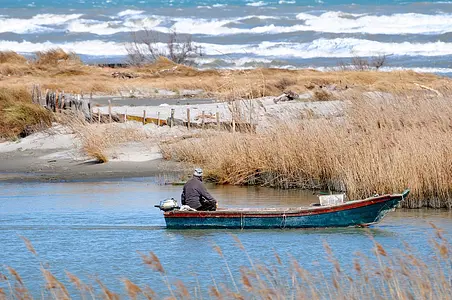
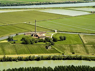
This branch of the Delta is served by two bridges: the first at the onset, just after the divergence from the Po of Venice, just upstream of Ca' Tiepolo; the other, on barges, almost at the mouth, at Santa Giulia. This makes it possible to follow its embankment roads in one direction or the other, closing the loop itinerary. That said, one enjoys the view of a countryside maintained mostly in rice paddies with isolated courtyard farms of Venetian foundation. The river proceeds slightly sinuous for several kilometers: few, the inhabited centers: on the eastern bank, Donzella, Gnocca, Santa Giulia; on the western bank, Ca' Vendramin, Polesinello, Oca Marina, Ca' Lattis, Gorino Sullam.
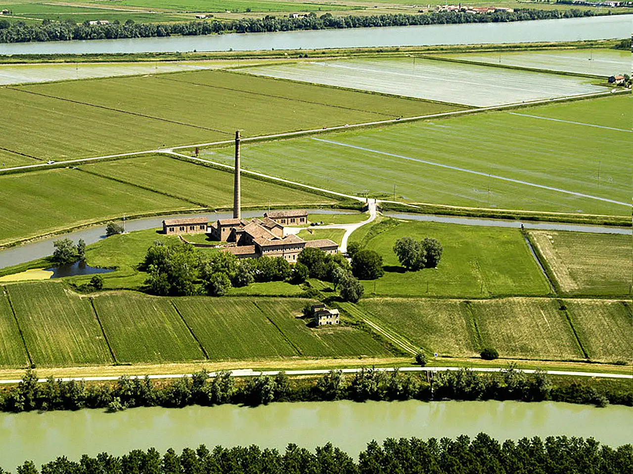
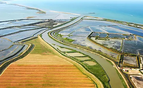
Interestingly, in the reclaimed lands of the Delta, localities have names that refer to the Venetian families who owned large agricultural estates there. This is the case, for example, of Gorino Sullam, precisely, in whose toponym one catches the assonance with the name Solomon, which in fact refers to a well-known family of Jewish lineage. Large tracts of the surrounding territory actually fall within an enormous landed estate, as many as 1,700 hectares, where between the nineteenth and twentieth centuries rice cultivation was brought to avant-garde levels thanks to the adoption of steam-powered machines and the first chemically synthesized fertilizers.
Enter the Map of Italy's Undiscovered Wonders and find treasures where you least expect it... Inspire, Recommend, Share...
Contact
Collections
Discover places and related research

The Map thanks:
Enter the Map of Italy's Undiscovered Wonders and find treasures where you least expect it... Inspire, Recommend, Share...
Index
INTRODUZIONE
The Po Delta
1 di 7
The Po di Levante, from Adria to Porto Caleri
2 di 7
The Po di Maistra, from Ca' Venier to Boccasette
3 di 7
The Po di Pila, from Porto Viro to the lighthouse at Punta Maistra
4 di 7
The Po delle Tolle, from Ca Tiepolo to the Sacca di Scardovari
5 di 7
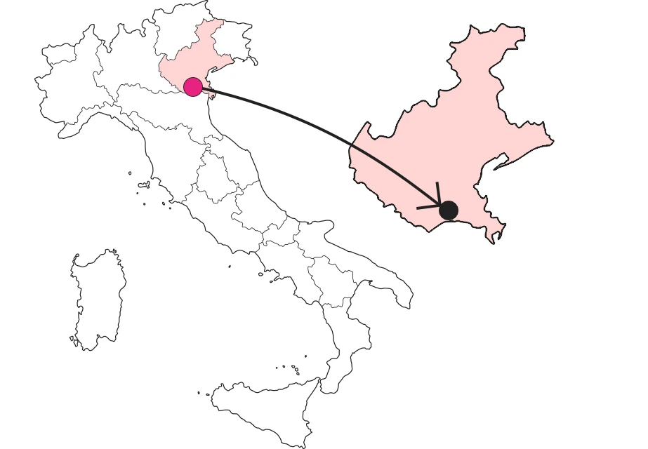
The Po of the Hottie, from Ca' Tiepolo to Santa Giulia
6 di 7
The Po di Goro, from Ariano in the Polésine to the Bacucco lighthouse
7 di 7
The Po di Volano, from Ferrara to Pomposa Abbey.
Where is
Contact
Collections
Discover places and related research
